Mario Tama/Getty Images
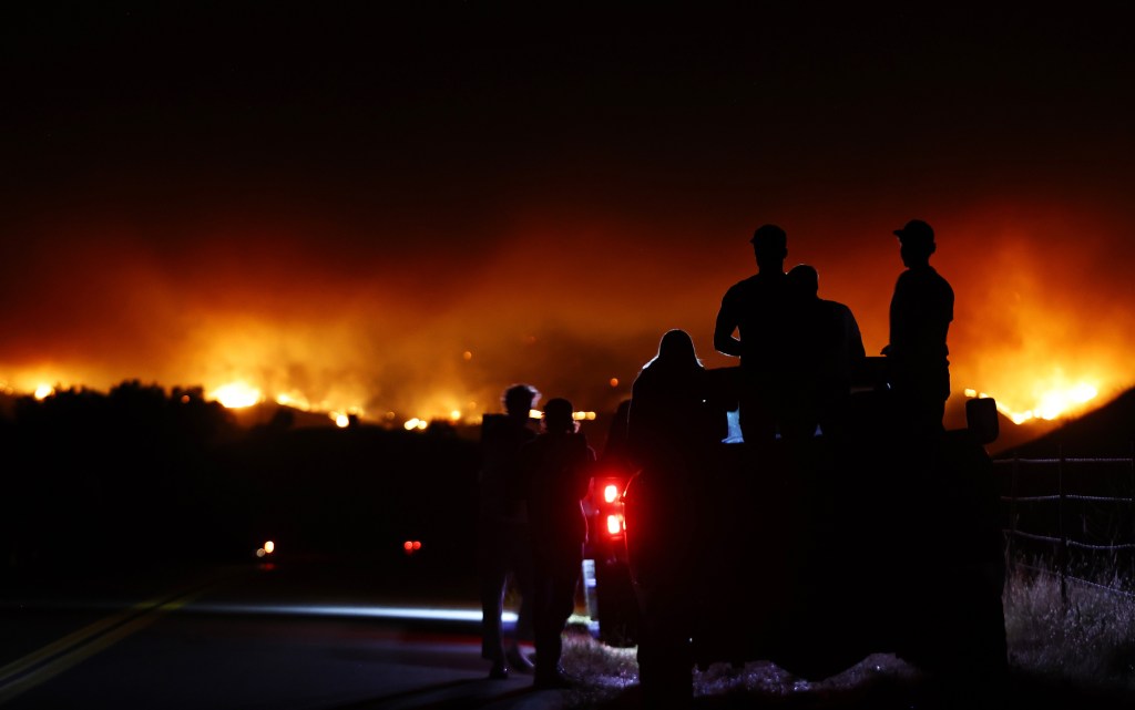
Los Angeles is currently partially surrounded by fires after numerous mostly scattered fires have raged in the region in recent weeks, including one in La Tuna Canyon, two in Angeles National Forest, one in Redlands, one north near Palmdale, and a sixth fire, the largest in the state this year, continues to burn inland from Santa Barbara.

That has resulted in evacuations, highway and road closures, efforts to secure properties and searches for groups of teenagers who may be in the path of the flames in the past 24 hours alone.
Among the current fires is a brush fire along the Foothill (210) Freeway in Tujunga that has burned about 29 acres of vegetation.
Firefighters responded to the blaze burning on the east side of the highway near La Tuna Canyon Road around 4:10 p.m., and the fire was burning at a moderate rate in “light to moderate” brush, according to Los Angeles Fire Department spokeswoman Lindsay Lantz.
LAFD crews were forced to close two eastbound lanes of the 210 Freeway to allow water tankers access to the area.
It’s unclear what prompted the brushing.
To the east, a wildfire broke out today in Angeles National Forest above Glendora, sending up heavy smoke and burning quickly near popular campgrounds and hiking trails, including the Bridge to Nowhere.
The Fork Fire was reported in the area of Glendora Mountain and East Fork roads around 3:30 p.m. and was initially estimated at 5 to 10 acres. By 4 p.m., it was reported at 75 acres, more ground and air resources were dispatched to the scene and a second alarm was issued.
By 5 p.m., reports from the scene indicated the fire had grown to an estimated 249 acres.
Firefighters on scene initially requested medical teams to treat a young child for burns and suspected smoke inhalation, but later reported no patients at the scene. No other details were immediately available. Firefighters also requested air support to search for a group of boys who had been at the scene before the fire began.
The fire is close to the Camp Williams Resort campground, raising concerns for people who may be in the area and prompting increased efforts to protect properties in the area.
Firefighters and police were evacuating people from the area.
East Fork Road was closed from Highway 39 to Glendale Mountain Road.
The National Weather Service reported temperatures near the fire were in the mid-80s Fahrenheit and winds were relatively light, with gusts of up to 12 mph.
Amid extreme heat and gusty winds, a wildfire raged through about 300 acres of brush in Palmdale today.
The Deer Fire was reported around 2:30 p.m. in the area of North 35th Street and Avenue Q, according to the Los Angeles County Fire Department.
The fire was initially reported to be about 10 acres in size, but the flames quickly spread through the brush and grew to about 100 acres by 3 p.m. Less than an hour later, the fire was estimated to be 300 acres in size.
The fire was upgraded to a second alarm as the scene commander requested additional resources to the scene.
Firefighters on the scene reported shortly before 4 p.m. that efforts to slow the blaze were progressing well. According to a map updated late Friday afternoon, the fire has grown to 272 acres.
The National Weather Service reported that temperatures in Palmdale were approximately 102 degrees Fahrenheit at the time the fire started, and wind speeds near the fire reached 24 mph, with gusts of up to 36 mph.
This is in addition to a smaller 10-acre fire that broke out north of Redlands Airport around 3:30 p.m.
Additionally, the Lake Fire in Santa Barbara County started more than a week ago and had grown to more than 38,000 acres as of Friday afternoon.
More than 2,000 firefighters have been deployed to the blaze, which is the state’s largest fire this year, and is thankfully 73% contained after more than a week.
Los Angeles is not the only city under attack.
Cal Fire statistics updated today show that there have been about 700 more wildfires so far this year than at this time in 2023. Additionally, at this point in 2023, 22,073 acres have burned. This year, it’s 248,972 acres. The five-year average for this time of year is 108,260 acres burned.
Just yesterday, the National Joint Fire Agency, which helps pool resources among western states, reduce costs, and coordinate fire suppression and planning activities nationwide, raised the national preparedness level to its highest number, 5. Like hurricanes, 5 is not good.
The ranking means “significant deployment of national resources is occurring and additional measures are being taken to support communities where possible. The full deployment of national resources is ongoing and the likelihood of major wildfires is high and is expected to remain elevated in several regions.”
City News Service contributed to this report.

